Eaux Claires
-
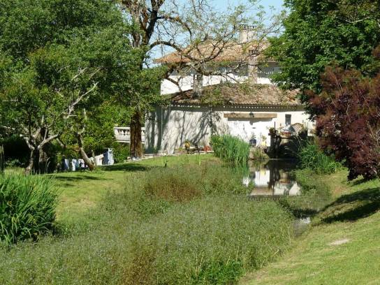 Photo creditJack maLicenseCC BY-SA 3.0
-
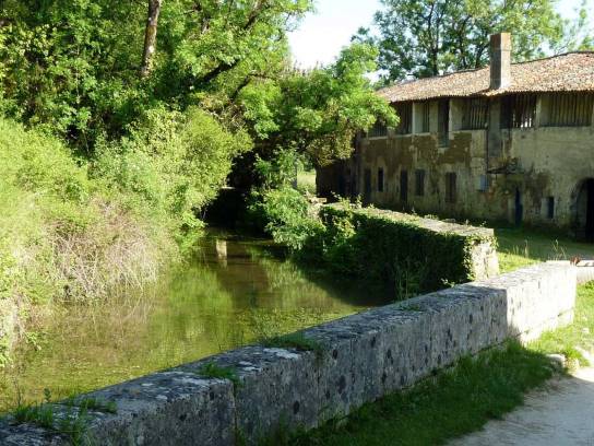 Photo creditJack maLicenseCC BY-SA 3.0
-
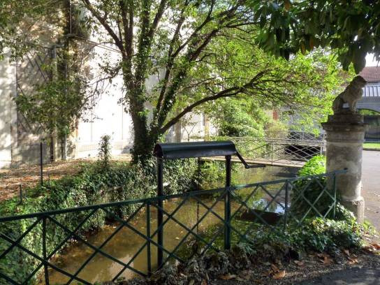 Photo creditJack maLicenseCC BY-SA 3.0


About
A small tributary on the left bank of the Charente, the Eaux Claires is one of the most iconic watercourses in the southern part of the Angoulême conurbation. The stream flows through seven municipalities before joining the Charente at Saint-Michel. It is closely linked to a long history of mills, paper-making and the use of water.
Discover
Geography
The Eaux Claires have their source in the La Prévalerie area, in the municipalities of Torsac and Dirac, at an altitude of approximately 108 meters. They flow generally north-westwards before joining the Charente at Saint-Michel, at a place called Chantoiseau, at an altitude of approximately 27 meters. Its actual length is generally given as 13.7 km in hydrographic sources; however, the Eaux Claires catchment area may be shown as having a greater length when associated networks and canals are included.
The watercourse belongs to the Charente catchment area, which is itself a tributary of the Atlantic Ocean.
Its water supply is largely derived from groundwater in the area’s limestone formations. At Puymoyen, the Turonian limestone aquifer is notably drained by the Eaux Claires, with numerous resurgences and springs feeding the watercourse.
Hydronymy
The name ‘Eaux Claires’ is directly linked to the stream’s water and its crystal-clear nature.
Unlike some neighbouring watercourses, whose ancient etymology is well documented, the precise linguistic origin of this name is less firmly established in the available sources.
Towns and villages through which it flows
From source to mouth, the Eaux Claires flows through or runs alongside:
- Torsac
- Dirac
- Puymoyen
- Vœuil-et-Giget
- Angoulême
- La Couronne
- Saint-Michel
The river thus flows through several areas in the south of the Pays d’Angoulême before joining the Charente.
Tributaries
According to the main hydrographic data, the Eaux Claires has no officially identified major tributary.
However, the hydrological functioning of the area is far more complex than that of a simple, isolated watercourse: springs, resurgences, ditches, small watercourses and old canals all contribute to the supply and circulation of water.
In Vœuil-et-Giget, for example, the Pré de la Fontaine stream, fed in particular by the Roche resurgence, is described as a minor tributary of the Eaux Claires. It is, however, a secondary watercourse, distinct from the main tributaries of the hydrographic network.
Flora and fauna
The course of the Eaux Claires flows through a wide variety of habitats: wetlands, woodland, meadows, springs, cliffs and limestone grasslands.
This diversity fosters a high level of biodiversity. The south-facing limestone slopes, in particular, feature thermophilic vegetation of a Mediterranean nature, whilst the areas close to the stream are cooler and more humid.
Notable species and habitats monitored in the area include:
- limestone grasslands;
- the stubble-grass;
- the Thyme Blue, a butterfly associated with limestone grasslands;
- the Mercury, another butterfly characteristic of these habitats;
- riparian woodland vegetation along the watercourse;
- fauna associated with wet, wooded and rocky habitats.
Biodiversity stems in particular from the contrast between the dry, highly exposed cliff habitats and the cooler areas at the bottom of the valley.
Development
The Eaux Claires has been heavily utilised by humans over the centuries.
The water management system includes, in particular, mill races, mills and old canals. Several mills were linked to the paper-making industry. The river’s historical function relied on diverting part of the water to industrial facilities.
Further downstream, the water notably fed the water systems associated with the former paper mills at Rochefort, Petit Montbron, L’Escalier and Chantoiseau. Some of these canals are now disused or have been partially preserved.
Contemporary management focuses in particular on:
- maintenance of the riverbed and banks;
- management of riparian vegetation;
- the restoration of aquatic habitats;
- combating bank erosion;
- the restoration or planting of riparian vegetation;
- improving the ecological quality of the watercourse.
History
The waters of the Eaux Claires have played an important role in human settlement in the area.
The numerous caves and cavities in the limestone areas bear witness to an ancient human presence. In Puymoyen, archaeological research has notably revealed traces of prehistoric occupation in several cavities, including the Grotte du Verger.
From the modern era onwards, water became an essential industrial resource. The valley was home to several mills, including paper mills.
The most famous is the Moulin du Verger, first recorded in the 16th century. The paper-making tradition is still upheld there, with paper produced by hand, sheet by sheet.
Les Eaux Claires has thus helped to shape a landscape combining watercourses, mills, millstreams, canals, cliffs and human settlements.
Heritage
The heritage directly associated with Les Eaux Claires includes, in particular:
- the Moulin du Verger, a former 16th-century paper mill;
- the old mill races and hydraulic structures;
- the remains of the former paper-making facilities;
- the caves and rock shelters;
- the former mushroom farms;
- the cliffs and limestone boulders;
- certain dwellings and buildings situated in the river area.
The Moulin du Verger, in particular, is a remarkable example of the link between water resources and local economic history.
The valley
A distinction should be made between the Eaux Claires watercourse and the valley of the same name.
The valley forms a steep-sided valley dominated by limestone cliffs. These landforms were shaped by erosion and by the processes of limestone dissolution and fracturing. The natural cavities subsequently encouraged early human settlement.
The Puymoyen area has also become a major rock-climbing destination, thanks to the limestone cliffs overlooking the river. This activity is now an integral part of Eaux Claires’ image as a tourist destination.
Protection
Les Eaux Claires is covered by several environmental protection schemes, particularly in the valley area.
The area forms part of the ‘Vallées calcaires péri-angoumoisines’ Natura 2000 site, which protects remarkable habitats and species in the limestone valleys around Angoulême.
Part of the area also benefits from landscape protection: the rocks overlooking the valley between Chamoulard and Rochefort are listed, whilst the valley itself is protected as a designated site.
The Nouvelle-Aquitaine Conservatory of Natural Areas has been working since 1998 to preserve certain areas of the valley. In particular, it owns and manages around 15 hectares in Puymoyen and carries out grazing, scrub clearance and restoration of limestone grasslands.