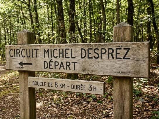
Michel Desprez Circuit
The Michel Desprez Trail is an easy 8.4-kilometer hike in Puymoyen, designed to let you explore the area’s natural and built heritage while enjoying a pleasant walk.
Tracé du parcours de randonnée
Départ / Arrivée du parcours
 Itinéraire à télécharger (format GPX)
Points of interest to see along the way
- Saint-Vincent Church (12th century).
- Milestone from the ancient Roman road.
- Eaux-Claires Climbing Cliff.
- Moulin du Verger: famous for its handmade paper and the story of Marie-Bernadette Dupuy.
- Petit Rochefort Well (16th century).
- Château du Diable gate: carved decoration depicting devils (private property, visible from the outside).
- The Eaux-Claires Valley and its varied landscapes: dry grasslands, limestone cliffs, and remarkable flora and fauna.
Itinerary
Follow the route clockwise.
Starting point - Puymoyen Community Hall
- Head to the roundabout near the shops and town hall.
- Turn right onto Rue du Bourg.
- Pass in front of Saint-Vincent Church.
- Turn right onto Chemin des Rochers.
- Walk down to the road and turn right to see the milestone marking the ancient Roman road.
The Eaux-Claires Cliffs
- At the intersection, turn right.
- Turn right immediately beneath the cliffs.
- Walk along the famous Eaux-Claires climbing site.
- Pass by the Moulin du Verger, known for its traditional paper-making.
- Continue straight ahead, ignoring the side paths, until you reach the Eaux-Claires Valley Road.
- Follow this road to the right for about 600 m.
Crossing the woods
- Leave the road and enter the woods via the path on the right behind the house.
- Continue along Rue du Château du Diable.
- Follow the main path to the right to reach Place du Petit Rochefort.
- Turn right at the end onto Rue des Grands Champs.
- Head straight ahead onto Sentier du Chêne Vert.
- Turn right before the gate.
- You’ll come out onto a path between a hedge and a meadow.
- Turn left at the end onto Chemin des Grandes Vignes.
Toward the Verger neighborhood
- Take the first street on the right.
- Turn left immediately onto Rue du Verger.
- Before the turn, notice the cross in a flower bed in front of a house.
- Continue left onto Impasse du Verger, then onto Rue du Cormier.
- Continue along the path until you reach Rue d’Angoulême.
Return to Puymoyen
- Cross Rue d’Angoulême at the crosswalk.
- Continue straight ahead on Rue des Brandeaux for about 500 m.
- Before the bridge, turn right onto the dirt path running alongside the bypass.
- Stay on this path, then keep to the right.
Final stretch
- Leave the wide path and take a trail on the right.
- Join Rue des Gears.
- Follow it to the left.
- Turn right after about 50 meters to rejoin the GR® 36 trail.
- Follow this trail to the community center, the starting point.
Pets allowed
Yes (kept on a leash)
The Michel Desprez Trail is ideal for combining semi-rural landscapes with nature, featuring historical sites and picturesque views in the Eaux-Claires Valley.
This hiking trail is part of the departmental plan for walking and hiking routes (PDIPR).
Type of itinerary
Loop
Difficulty
Easy
Distance of the circuit
8,4 km
Estimated hiking time
2 hr 50 min
Beaconing
Yellow
Start of the hike
Salle des fêtes de Puymoyen
Rue de Peusec
16400 Puymoyen
France
-
 Crédit photoIndia AlphaLicenseFree Art License
 -
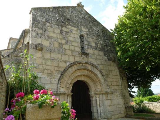 Photo creditJack maLicenseCC BY-SA 3.0
 -
 Photo creditgoldObotLicenseFree Art License
 -
 Photo credit© PropriétaireLicenseAll rights reserved
 -
 Photo creditGoogle streetLicenseAll rights reserved
 -
 Photo creditPatrick JanicekLicenseCC BY 2.0
 -
 Photo creditJack maLicenseCC BY-SA 3.0


Conseils pratiques et recommandations
Pour rendre votre randonnée agréable
- Ne surévaluez pas vos forces physiques.
- Renseignez vous sur le temps de parcours, sur la météo.
- Évitez de partir seul.
- Emportez une gourde d’eau, une trousse à pharmacie, une carte IGN, une boussole.
- Soyez équipé d’un sac à dos, de chaussures de marche, d’un vêtement chaud, d’un vêtement de pluie, d’un chapeau.
Météo